Near L'Anse aux Meadows

Near L'Anse aux Meadows

Tuesday, October 19, 2010


Sept 29

I was up with the dawn and greeted with- what else- more rain.  It stopped in a few minutes.  Yea- I don’t have to break down my last camp in the rain.  Things were actually able to dry a bit as I packed.


I was off to breakfast at a small mom & pop diner.  The bill came to $4.65 for eggs, sausage, toast, hash browns and tea. 

I need to check out this area of New York again.  It’s very pretty with lots of homes built long ago with big money.  I’ll cross the bridge at Niagara, cross Ontario, and return to Michigan over the Blue Water Bridge.

I passed the 5000 mile mark for the trip:


Not many pictures today- I could smell the barn and wanted to get home.  More rain- LOTS MORE- is predicted from Ohio east and I have had my fill of wet camping.

The sun set as I was approaching Sarnia. 


Only about 90 minutes to home:


I made it home safely, and got to sleep in a warm, dry bed, without blowing up my air mattress first.

Monday, October 18, 2010

Sept 28


Sept 28

It was only raining a little bit thru the fog this morning.  I got up at dawn, had a shower, packed up, and headed west on US 2.  


 It’s one of the prettiest roads I’ve ever been on.  At some point, it changes to US 9.  The color in the trees is awesome.  Entire mountain sides in color, with each creek outlined in a different tree specie and color.  Some of the mtns are mostly the same color, some are patch work, and some are random.  Neat!


There is a mtn on US 9 in Vermont that has lots of twists & turns in the road.  Lots of fun on a bike.  People with big campers and trailers were having less fun.  


 They are building (rebuilding) a bridge across Lake Champlain, so I got to take the ferry.


Mostly today was overcast, with occasional peaks at the sun and occasional drizzle or fog.  It was quite cold when I left Maine and got steadily warmer as I traveled west.  I stopped to adjust layers many times.  Eventually, I was just wearing a shirt under my rain and bike jackets.  Near Lake Placid, NY, I came around a corner, into torrential COLD rain.  No warning, no chance to put on more clothes, no where to safely stop.

At that point, I told the GPS to take me home, on the interstates.  At least I can find a (somewhat) affordable room, not like the high rent district I was going thru.  Eventually, I came to a rest stop and was able to get into my heated jacket and fleece before I froze.  Naturally, the rain stopped while I was inside getting dressed.  A bit further south a series of signs pointed to camping, food, and lodging.  I found 3 closed campgrounds, 2 private campgrounds, and 2 “campgrounds” that only rent cabins, and did not find 2 other campgrounds.  Once again I figured “the hell with it” and told the GPS to get me home.

About 100’ after I stopped to push buttons on my GPS, I actually found a campground – open, welcoming, and run by a nice couple.  They will even cook me breakfast in the morning for a few $’s.  I asked where I could get dinner, and my hosts recommended a nearby restaurant.  It was closed, but a mile farther was a tavern with really good food and beer.  I ate my fill and desperately wanted more than my “riders ration” of one beer.

I’m back in my tent now, no internet again.  My tent is still soaked- I had to mop up the floor with my chamois.  I didn’t bring many natural fiber items with me.  Those I did are rotting- my $25/pair wool socks :-(  Everything else does not smell so good.

Tomorrow I’ll poke around Adirondack park a bit, and maybe get home.  Maybe.

Friday, October 15, 2010

Sept 21


Sept 21
Today is the day to climb Gros Morne. 


I tried for an early start, but nothing here opens until 9am.  After a stop at the “grocery” store and checking in at the visitor’s center for a trail guide, it was 10am before I hit the trail.  It starts in a forest, 


climbs up the scrub (all scrub is called tackamore here),


over the scree, and up to the top.  It’s only 806 meters- like 2500’.


The views are awesome!  Luckily, the clouds were above the mtn.  According to the rangers, if the clouds are on the mtn, the climb is a no-go. Believe this sign!


When I was about ½ way up, a pair of women got to the bottom.  They were climbing much faster than me and the first one, “grumpy” past me shortly, without a word and without breaking a sweat.  She looked ticked.  About 10 minutes later, here friend, “friendly” past me.  She was working HARD, dressed in cotton, but in good spirits.  We chatted for a bit and she continued up.

Self portrait from about 2/3 up the mountain
Lookin' sexy!

A bit farther up the mountain, Colleen and (nuts- Anthony?) from the Norseman Restaurant caught up to me.  We chatted for a bit and causally joined up for the hike.  It gets very barren at the top- arctic environment.  

Hurricane Igor was ravaging St John’s with 8-9” or more of rain and wind.  We only got the WIND.  Near the top, winds were about 70mph.  There were many times all 3 of us had to drop down as low as possible to avoid being blown off of our feet.  The temperature was about 45, windchill f%^&*ing cold.  We had suitable clothes, so no big deal.  


The 3 of us had a snack at the top and continued down- it’s a longer, more gentle descent on the back side of the mtn.  The view of the gorges is awesome.   


And there are blueberry bushes everywhere.   


They were a welcome snack.  Thanks to my companions for pointing them out to me!

And, we saw a ptarmigan in the woods.  She was not too concerned about us- probably waiting for a handout.  

Thankfully I was camping in the same place tonight and my tent was all set up in a nice, sheltered area.  Some of the people that set up in the pretty, open area had to run guy lines to the top of their campers to keep them from blowing over!  I was not about to take pictures- too much sand and other junk flying sideways.

Thursday, October 14, 2010

Sept 20

Sept 20

Time to start heading south. 

I camped in the cooking shelter last nite.  


 About dawn, I was in my sleeping bag and heard a moose walk past the shelter.  It was actually 2 mooses- a cow and her calf.


I hit the road and explored a bit of the area.  In much of NF, especially the north, people heat with wood.  Huge woodstacks are along the roads.  Sleds are used to haul the logs to the cutting site, then again to haul the firewood home.  


Lots of lobster traps everywhere, some stacked up in the woods, some along the shore.  Some of the stacks probably have 1000 traps.


Newfoundland and Nova Scotia have laid out many “routes”- good places for tourists.  They are labeled with signs like this.


I stopped at a lighthouse (this is the land of lighthouses!), and found my bike’s twin.  It belongs to a couple from Montreal who are touring the area.


The day before, a 65’ fishing boat ran aground here while fishing for mackerel.  Rookie captain (20 years old?) got too close to the rocks.  The boat broke up and is smeared all over the rocks.   


There is a STRONG smell of desiel fuel.  The park rangers have the shore cordoned off and the family is trying to salvage what they can.  The boat in the pics belongs to a brother and is trying to salvage something off the bottom.


Here are some pics of a typical marina:


Arches rock:


The SS Ethie, driven ashore in 1919


I got to the Gros Morne visitor’s center about 20 minutes after it closed.  Rats!  They could have told me that Berry Hill campground was closed.  I ended up at Green (point?) campground- no showers.  I have a very sheltered site- Igor’s wrath is coming.  Some people are camped in a beautiful area, but totally exposed.  They will not be happy later.  The ranger came by an chatted for quite a while, while my dinner was getting cold….

Tuesday, October 12, 2010


Day 8, Sept 19

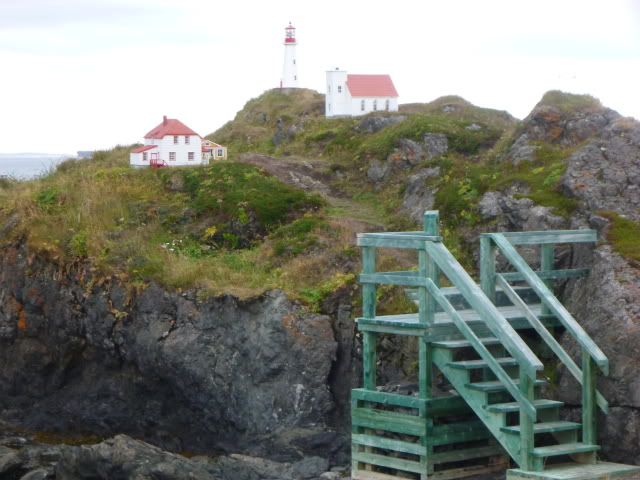
I had a great nite’s sleep, up at dawn, and did some exploring of the area. 


I took far, far too many pictures- thank you digital. 

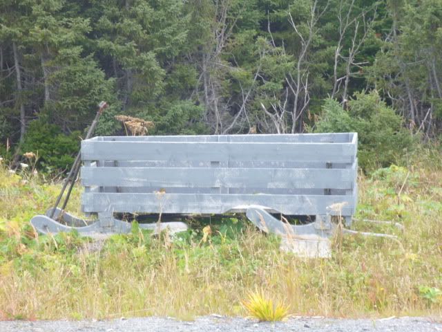
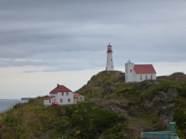
People here are into lawn art.  Some if it is amazing:


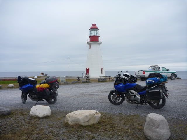
The lighthouse is about 30 inches tall!


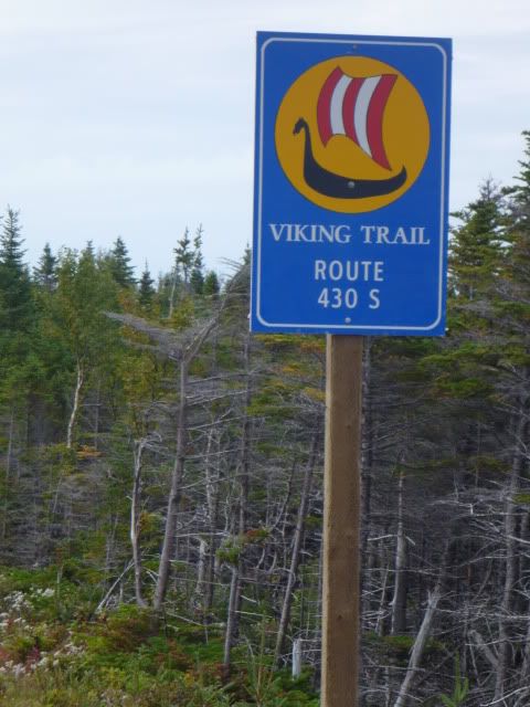
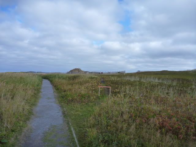
I got to the Viking site about 10 am, there were 10 cars in the parking lot.  It looks like a very desolate place.  Apparently 1000 years ago it was more lush.  


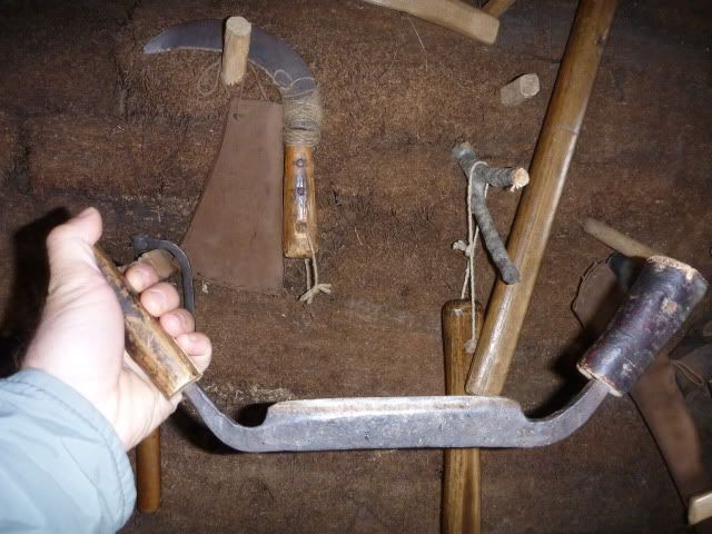
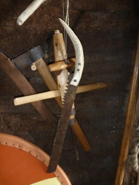
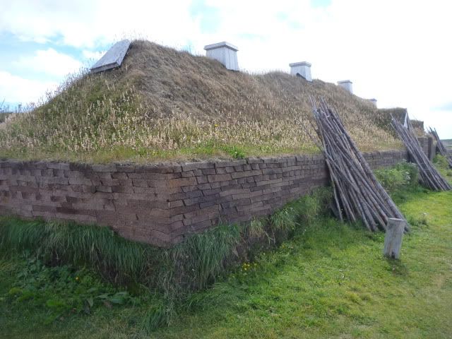
I took the tour, then talked with the “costumed interpreters” for more than an hour.  We talked about how their buildings were built- 6’ thick sod walls, with a layer of gravel running down the center.  The roof rests on the gravel layer, and the gravel allows for drainage. 

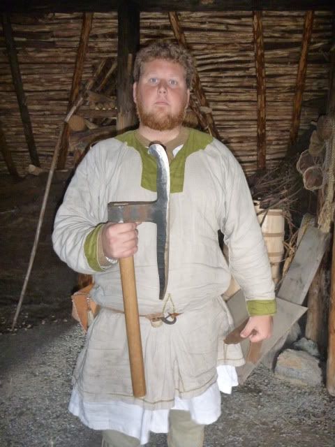
They have a set of Viking tool reproductions, accurate to the period.  Many of them look exactly like what I use to make kayaks…   


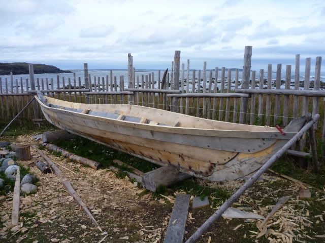
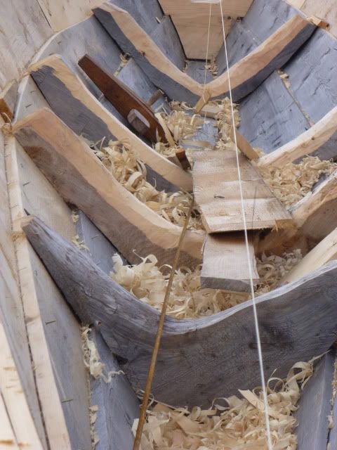
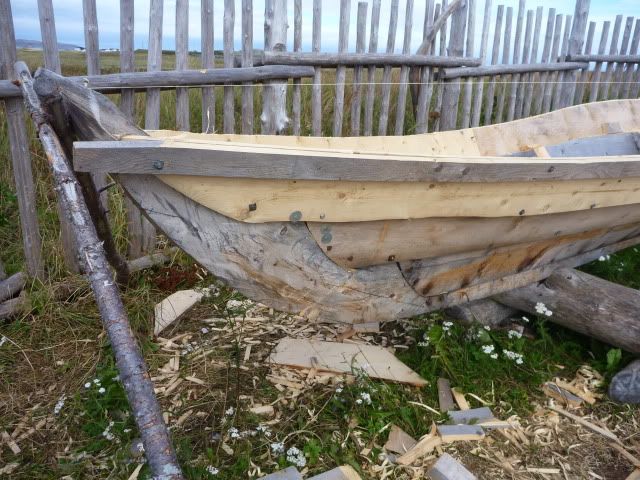
They are building a small boat- me thinks without the help of a boat builder.  The shape of the wood pcs is correct, but grain orientation is not, at least to my eye.  They are using pith wood in the stem & stern, etc.


One of the interpreters is very interested in building a kayak, so I gave him the site for Yostwerks.com.  

That's a gull ax- probably too much for building a kayak.  Perfect for a Viking ship tho- it's a replacement for both an adz and plane.

Reconstructed building:


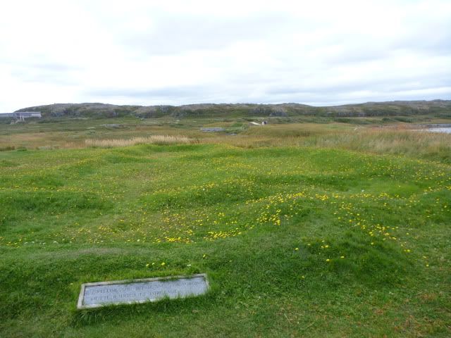
 Ruins of the original building.  They were excavated in the 1960's and 70's, then recovered with dirt to protect and preserve the site.


 Another is playing traditional NF music at a restaurant tonite.

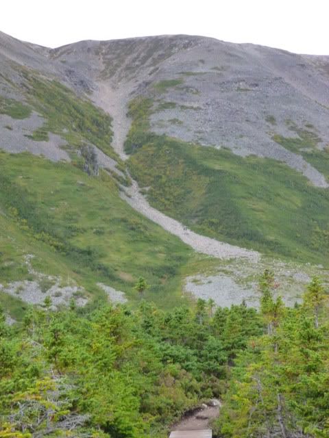
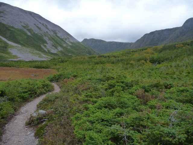
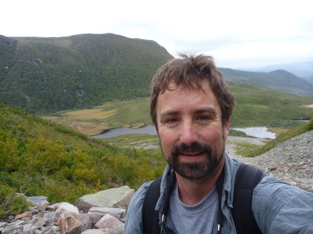
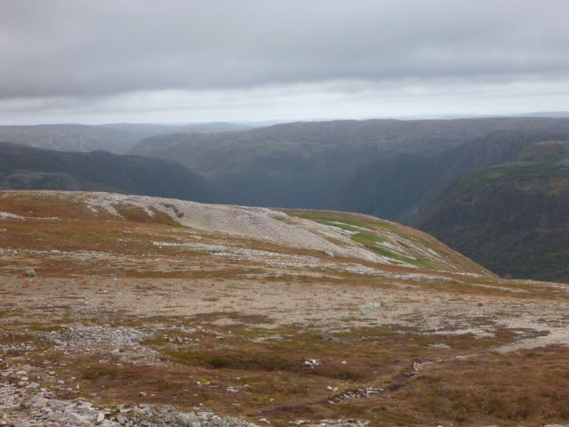
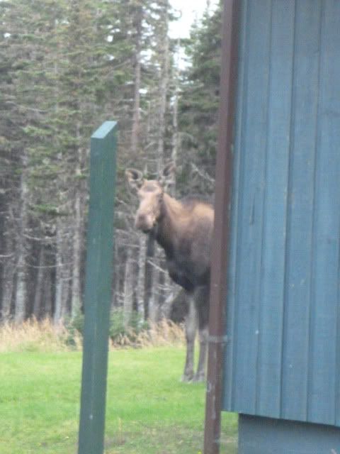
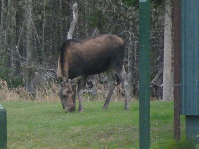
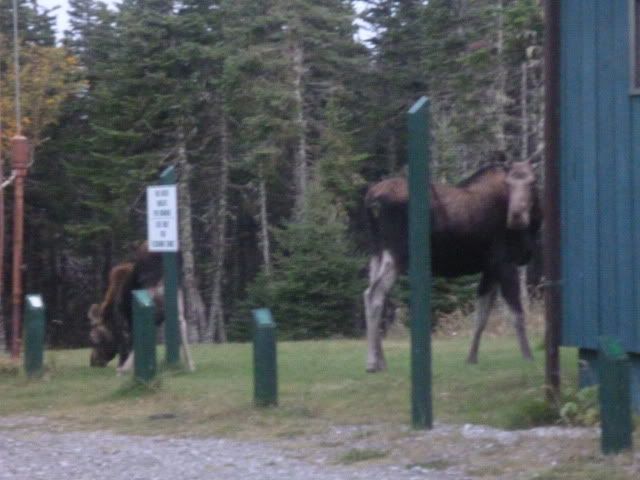
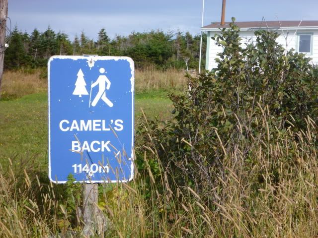
Saw a pair of moose (bull & cow) from the visitor’s center, then it was off to a hike recommended by the park staff- Camel’s Back.  The sign said something like trail, 1140 meters- awfully precise! 


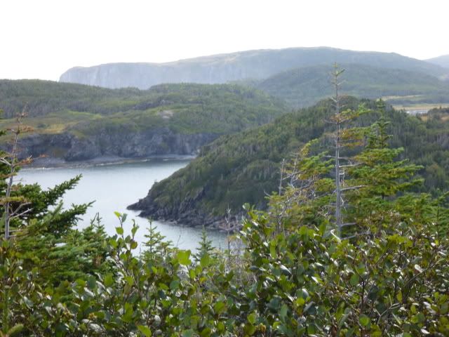
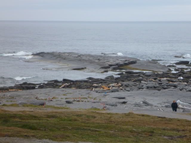
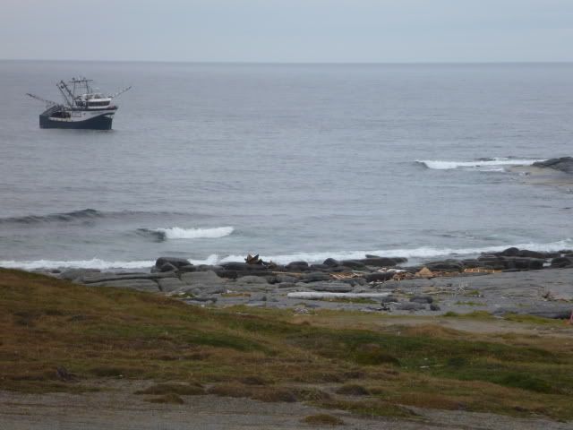
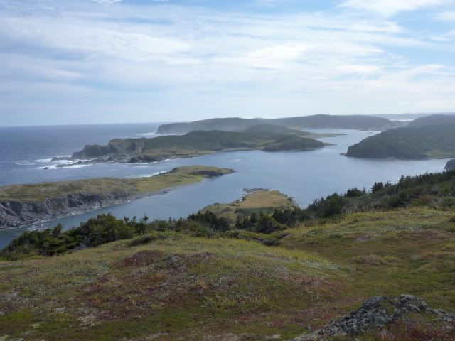
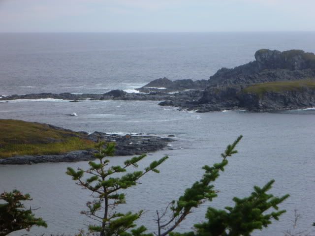
After hiking it, I’m sure that’s the GPS distance between the start and turn around point.  Maybe twice that on foot.  It was a beatufull hike out to one of the big promontories of the shore. 


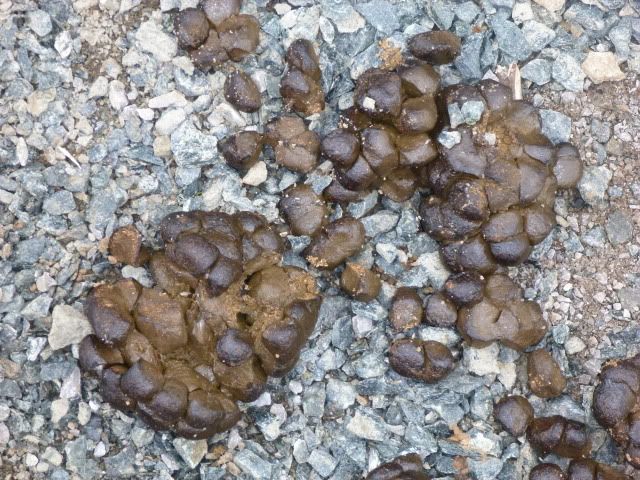
Lots of moose track- at least one set all along the trail.  Ii sections, there was moose poop every 100’ (some very fresh).


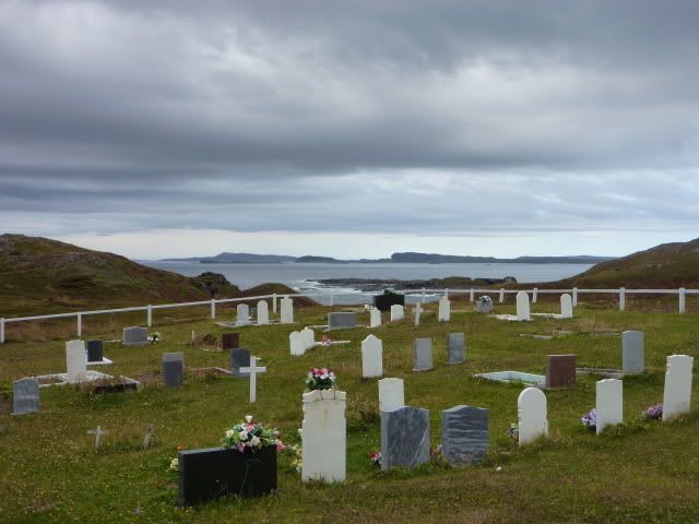
I explored around a bit more, found a cemetery overlooking the ocean.  Nice spot. 


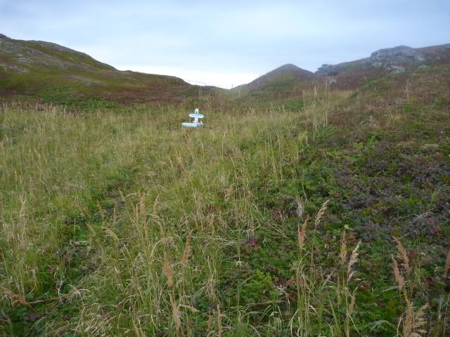
There was one small grave away from the graveyard;  little boy, only 2 days old.  My only thought why he is not in the cemetery is he was not baptized & thus no eligible for consecrated ground(?)  :-(


I did get to the NorseMan restaurant for dinner good, pricey.  Wade was a good performer and looks very Viking. I bought a CD.  Of the 4 groups of people at dinner, 3 were from MI.  One woman grew up in New Baltimore and visits her parents there.  She is another musician, has lived in Bend, OR, and is now in Calgary.  Her website is here:  http://colleencole.net/

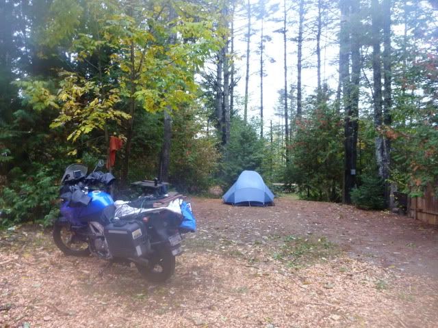
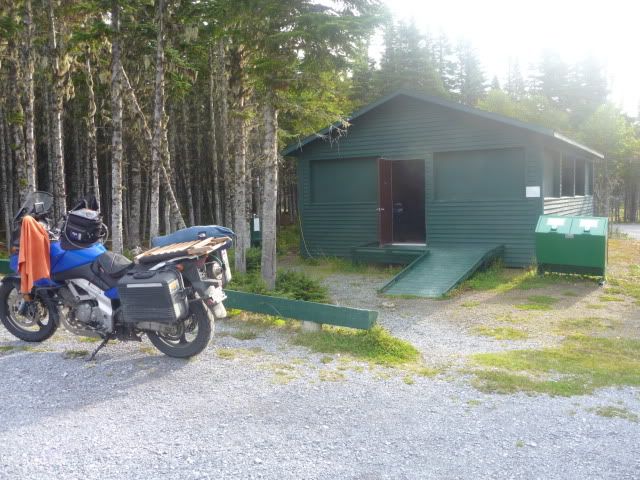
I camped out in the cooking shelter at Pistolet Bay Park.  Again, only 2 of us here.  Monday is the last day for the park this season.  I guess I’m closing the place.

I uploaded many, many more pictures to my photobucket account.